Guayaguayare (Ward of Guayaguayare)
Guayaguayare is the southeasternmost village in Trinidad & Tobago. It lies at the southern end of the county of Mayaro. Guayaguayare (often simply called Guaya) is primarily a fishing village, but it also plays a major role in the petroleum industry. The largest petroleum producers in the country - BP Trinidad & Tobago (bpTT), BHP and Petrotrin all have major presences here and bpTT controls the Port of Guayaguayare, which services most of the offshore petroleum production in Trinidad. The major natural gas pipelines, serving Atlantic LNG in Point Fortin and the Point Lisas Industrial Estate, come ashore here.
Guayaguayare was the first area in Trinidad sighted by Christopher Columbus on July 31, 1498. The area along Guayaguayare Bay, between the Lizard River (originally Rio de Iguanas) and the Pilote River (Rio de Pilotas) was settled by French planters and their slaves in the late eighteenth century following the 1783 Cedula de Población.
Guayaguayare also has a prominent place in the history of the oil industry - it was the site of the first commercially viable wells drilled in Trinidad by Randolph Rust and Lee Lum in May 1902.
It is the birthplace of Jillian Richardson who won a silver medal for Canada at the 1984 Olympics in the 4x400 metres.
Map - Guayaguayare (Ward of Guayaguayare)
Map
Country - Trinidad_and_Tobago
 |
 |
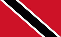
| Flag of Trinidad and Tobago | |
The island of Trinidad was inhabited for centuries by Indigenous peoples before becoming a colony in the Spanish Empire, following the arrival of Christopher Columbus, in 1498. Spanish governor José María Chacón surrendered the island to a British fleet under the command of Sir Ralph Abercromby in 1797. Trinidad and Tobago were ceded to Britain in 1802 under the Treaty of Amiens as separate states and unified in 1889. Trinidad and Tobago obtained independence in 1962, becoming a republic in 1976.
Currency / Language
| ISO | Currency | Symbol | Significant figures |
|---|---|---|---|
| TTD | Trinidad and Tobago dollar | $ | 2 |
| ISO | Language |
|---|---|
| ZH | Chinese language |
| EN | English language |
| FR | French language |
| ES | Spanish language |


